

This water tour begins at the highest part of Snake Valley, the southern end, and proceeds downstream towards the north. Snake Valley is part of the Great Salt Lake Flow System, with water eventually draining out of the valley into the Great Salt Lake Desert that borders the Great Salt Lake.
Big Springs
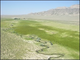
Big Springs is a large spring at the southern end of Snake Valley that has about 8 cfs (4 cfs from a springhead with a USGS gauge and 4 cfs from a nearby springhead) of water flowing year round. The water that comes from it supports Burbank Meadows, a wet meadow complex 20 miles long that supports a wide variety of wildlife, including thousands of migratory birds. The water flows in Big Springs Creek, home to five species of native fish, and continues on to Pruess Lake, home to the indigenous California floater, a large mollusk. Because Big Springs is closest to the water that the USGS says is coming around the mountain from Spring Valley (BARCASS 2008 report), and Southern Nevada Water Authority has plans to put wells in this area, it may be the first water source to be impacted in Snake Valley by largescale groundwater pumping.
Needle Point Spring
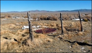
One example that shows that pumping can dry up springs in Snake Valley is the case of Needle Point Spring, located in the south part of Snake Valley. A series of wells were drilled from 1993 to 2000 to supply water for 13 center-irrigation pivots. In 2001, Needle Point Spring, only about one mile away from the nearest well, dried up. A number of wild horses died because they had imprinted on the spring and did not know where else to go for water. Although irrigation pumping only lasts from April to October of each year, water has never flowed again from Needle Point Spring. This spring is only a couple miles from Big Springs Creek.
Stateline Springs
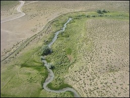
Stateline Springs are just a few miles north of Big Springs, and about 9 cfs of water rises here from a series of springheads, adding important water to the Big Springs system. This is excellent habitat for tiny springsnails and mottled sculpin, along with the other native fishes.
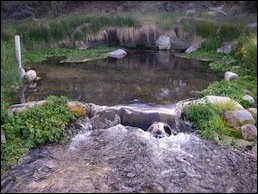
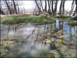
Clay Spring
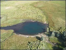
Clay Spring is located at the northern end of Burbank Meadows, with an upper smaller spring and the lower larger spring shown in the above photo. This spring originally attracted some of the first settlers in Snake Valley, the Clay family. Later it was used by the Civilian Conservation Corps (CCC) as a water source for their camp in the 1930s. The pool is very deep--no one knows exactly how deep.
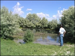
Pruess Lake
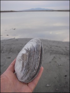
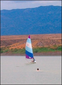
Big Springs Creek (sometimes called Lake Creek) is the inlet for Pruess Lake. The lake is located south of the town of Garrison. It was originally a small lake that was dammed in the late 1800s and now covers about one square mile. In addition to providing recreation opportunities, it is also home to the California floater, a mollusk species that has been around since Lake Bonneville days.
Meadows near Baker
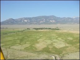
These meadows east of the town of Baker have springs rising in various locations. If the well applications near the town of Baker are approved, these springs will most likely be affected. In addition to supporting cattle, the meadows also are used by mule deer, pronghorn antelope, sandhill cranes, long-billed curlews, and many other birds.
Rowland Spring
Rowland Spring is located five miles east of the town of Baker, just inside the Great Basin National Park boundary. It flows at a near constant rate year round. Despite being nearly 1,500 feet higher than the valley bottom, the USGS has determined that this spring and others nearby could be susceptible to groundwater pumping in the valley bottom based on the geologic and hydrogeologic factors. See the Elliot et al 2006 report for more information.
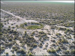
The Blowout
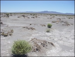
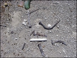
South of EskDale, a dune-like area with blowing sand can be found. In the middle of the small dunes is an old homestead, complete with square nails and old barbed wire. Why would anyone choose to build a home here? When it was built, the area was wet, with wetland vegetation surrounding it, but as the water table dropped, it has become a barren outback. A small change in the water table can mean life and death for many species.
Wheeler Spring & The Flat Spring
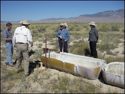
Wheeler Spring, a few miles north of Highways 6 & 50 near the Gandy Road, flowed freely into water troughs until the 1970s, when electricity entered Snake Valley and made it easier to pump more groundwater. Soon after additional wells were put into production, neither it nor the nearby Flat Spring had water emerging at the surface.
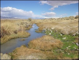
Beck Spring
This perennial spring 15 miles north of the Border Inn flows even during the driest times. Old-timer Tom Sims recalls when he lived at the nearby Smith Creek Ranch during the bad drought of the 1930s, this was one spring they could depend on. It supports an amazing diversity of life, including Columbia spotted frogs, spadefoot toads, springsnails, and speckled dace.
Twin Springs & Foote Reservoir
About 30 miles north of the Border Inn and 10 miles east of Gandy are Twin Springs and Foote Reservoir (fed by a spring)m both important water sources for several species. Least chub live in some of the springs, and the overflow from the springs goes out into a large marsh that is important frog habitat.
Fish Springs National Wildlife Refuge
Fish Springs National Wildlife Refuge is technically just around the corner from Snake Valley in Fish Springs Flat, but it receives over half of its water from Snake Valley. Fish Springs consists of many springs, which are used by native fishes and birds. Because of its isolation, the water at Fish Springs is an important oasis for migratory birds.